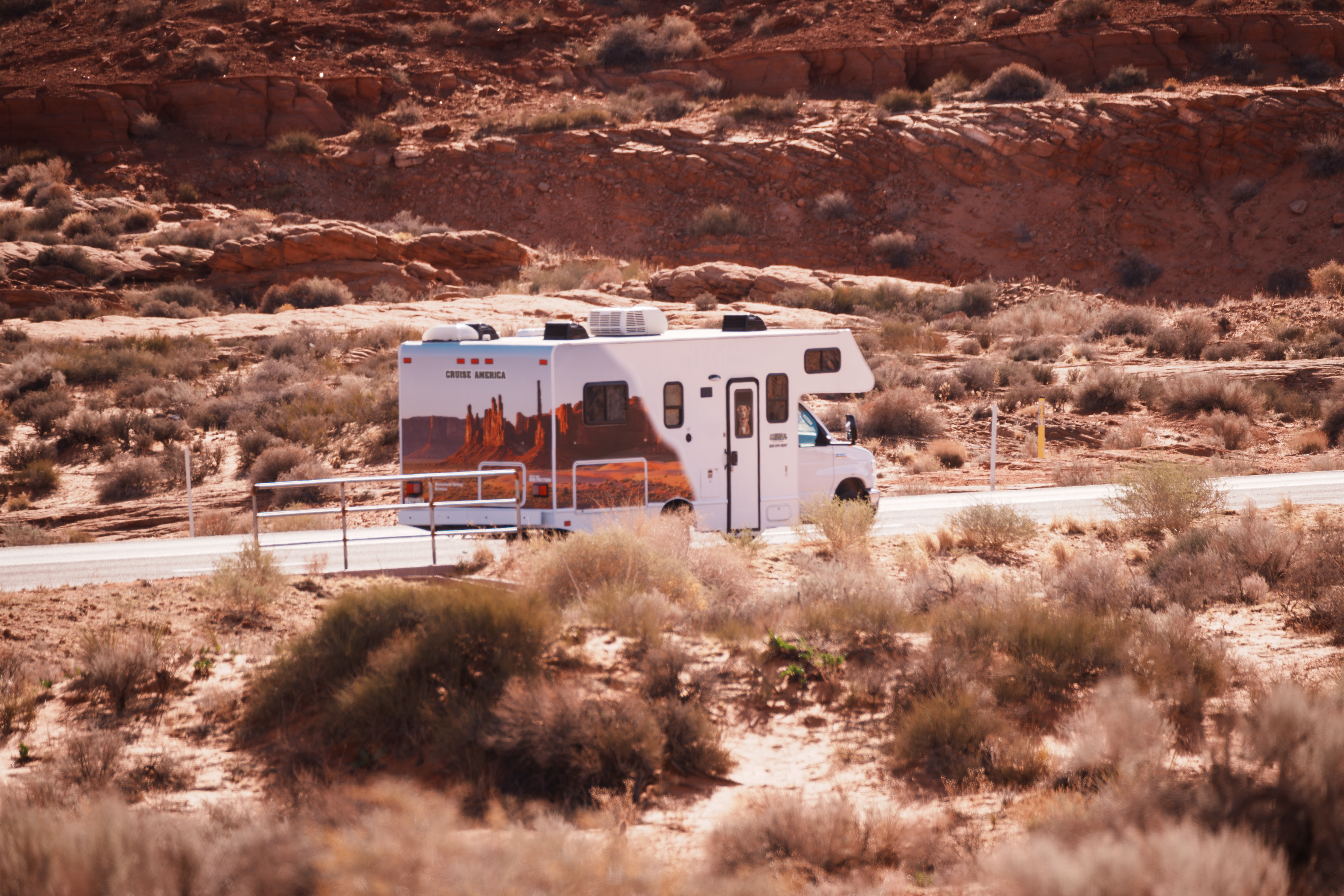
Everything to Know About Chiricahua National Park (Newest US National Park)
- National Parks
- get inspired
Key Points at a Glance
-
America's newest national park: Chiricahua National Park became the 64th national park in the U.S. and the fourth in Arizona on October 20, 2026, after 102 years as a national monument.
-
Where it is: The southeastern corner of Arizona, about 120 miles east of Tucson and roughly 36 miles from the gateway town of Willcox.
-
What makes it special: Thousands of rhyolite spires and balanced rocks, formed by a volcanic eruption roughly 27 million years ago, give the park its nickname, the "Wonderland of Rocks."
-
Top things to do: Drive the 8-mile scenic road to Massai Point, hike 17 miles of trails, tour historic Faraway Ranch, and stargaze under dark skies.
-
RV size matters: Bonita Canyon Campground fits vehicles under 29 feet, but the scenic drive beyond it is limited to 24 feet, so compact RVs get the most access.
-
Best time to visit: Fall and spring bring the most comfortable weather, though March is the park's busiest month. Visitation is expected to rise significantly with the park’s new designation, so plan and book ahead of time!
The stone spires of Chiricahua look like something from another planet. Thousands of rock columns, some perched on bases that seem impossibly narrow, crowd the canyons of the Chiricahua Mountains in a landscape the Chiricahua Apache knew as the “Land of Standing-Up Rocks.” For more than a century, this corner of the Southwest flew under the radar as a lesser-known monument. That changed in October 2026, when Chiricahua National Park officially joined the Grand Canyon, Saguaro, and Petrified Forest as one of the state's four national parks.
The new title is expected to draw more visitors, which makes now an ideal time to plan a trip. Because the park sits far from major cities and has just one small campground, an RV road trip is one of the easiest ways to visit. Here's everything you need to know, from the park's geology and best hikes to where to camp and which RV fits its narrow, winding roads.
Why Chiricahua Is Now America's 64th National Park
Chiricahua didn't gain any new land or attractions when it became a national park. What it gained was recognition. The rock spires, trails, and historic ranch that people have enjoyed for decades are all still here; the difference is that the site now carries the same title as Yellowstone and Yosemite, a label that tends to move a destination onto more travelers' bucket lists.
102 Years as Chiricahua National Monument
Long before it was called Chiricahua National Monument, this land was part of the Chiricahua Apache homeland, and the area holds evidence of thousands of years of human history. President Calvin Coolidge first protected it in 1924, using the Antiquities Act to preserve its hundreds of pinnacle-shaped rocks, and President Franklin D. Roosevelt expanded the boundaries in 1938.
The push for park status took years. Redesignation bills were introduced in Congress as far back as 2016, and several stalled before the latest version made it through. Here's how it unfolded:
|
Date |
Milestone |
|
1924 |
President Coolidge establishes the national monument |
|
1938 |
President Roosevelt expands it |
|
March 2026 |
House passes the redesignation bill by voice vote |
|
September 30, 2026 |
Senate passes the bill |
|
October 20, 2026 |
Bill signed into law, making Chiricahua the 64th national park |
At roughly 12,000 acres, Chiricahua is now the fourth-smallest national park in the country. What it lacks in size, it makes up for in scenery packed into every mile.
What the National Park Service Is Changing (and What Stays the Same)
For travelers, very little changes on the ground right away. The new law keeps the existing boundaries, adds no land, and leaves the National Park Service in charge. It also continues to protect tribal access for traditional ceremonies, and it allows temporary public closures in parts of the park to make room for those cultural uses.
Here's what you may notice over the next few years:
-
New signage: Interior Secretary Doug Burgum said updating signs to reflect the new name is the first order of business.
-
Infrastructure upgrades: New water systems and other maintenance projects are expected to follow.
-
Bigger crowds: A 2019 study of eight monuments that became national parks found that average yearly visitation rose 21% over the following five years.
Natural Features of the Wonderland of Rocks
The park's natural features are packed into a small area, so you can see a remarkable amount in a single day. Hoodoos, balanced boulders, and slender stone pillars crowd every canyon, and the park's high elevation creates a cool, forested refuge above the surrounding desert. In 1976, Congress designated nearly everything outside the road corridor as wilderness, so once you step off the pavement, the land is largely untouched.
How an Ancient Eruption Built the Pinnacles
Roughly 27 million years ago, the Turkey Creek volcano, just south of today's park boundary, erupted with about 1,000 times the force of the 1980 Mount St. Helens eruption. The blast left a caldera about 12 miles wide and buried the region in hot ash and pumice.
That ash fused into a layer of welded volcanic rock called Rhyolite Canyon Tuff, at least 1,600 feet thick. As it cooled, vertical cracks formed throughout the deposit. Over millions of years, water, ice, and wind worked into those cracks, widening them until only towering columns remained.
As you explore, look for named formations like Big Balanced Rock, Punch and Judy, Duck on a Rock, and the Organ Pipe Formation, many of them named by the Civilian Conservation Corps.
Wildlife on a Sky Island
The Chiricahua Mountains belong to a chain of 55 "sky island" ranges, mountains that rise high enough above the desert to support plants and animals that couldn't survive in the arid lowlands around them. Four ecoregions meet here: the Sonoran and Chihuahuan deserts, the Rocky Mountains, and Mexico's Sierra Madre. On the drive from the entrance to Massai Point, you'll climb nearly 1,500 feet, from grassland and oak woodland into pine forest.
That mix supports an impressive variety, including 71 species of mammals, 46 reptiles, eight amphibians, and more than 170 bird species. Animals to watch for include:
-
Coatis: long-tailed relatives of the raccoon that often wander through camp
-
Chiricahua fox squirrels: a squirrel found in these mountains
-
Larger mammals: black bears, white-tailed deer, javelinas, bobcats, and mountain lions
-
Birds: Mexican jays, acorn woodpeckers, and wild turkeys
-
Reptiles: western box turtles and banded rock rattlesnakes
Hikers should keep plenty of distance from wildlife, especially bears and rattlesnakes, and stay on marked trails.
Getting to the Park and Getting Around
The park is located in Cochise County, in the far southeastern corner of the state, and it's a true destination rather than a drive-through. Only one paved road goes in, and it dead-ends high in the mountains, so you'll enter and exit the same way. There's no entrance fee, and the park is open year-round.
|
Starting point |
Approximate distance |
|
Tucson |
120 miles |
|
Las Cruces |
200 miles |
|
Phoenix |
230 miles |
Directions: From I-10, take exit 336 into Willcox and follow AZ-186 southeast for about 31 miles. Turn left onto AZ-181 and continue 4 miles to the entrance. For GPS, use the park address: 12856 E Rhyolite Creek Rd, Willcox.
Note: Cell service drops out well before you arrive, so download your maps for offline use. Willcox is your last reliable stop for fuel and groceries.
Start at the Visitor Center
The visitor center is open daily from 8:30 a.m. to 4:30 p.m. Mountain Standard Time; keep in mind that Arizona doesn't observe daylight saving time. Stop in for a free hiking guide and map, current trail conditions, exhibits on the area's geology and people, and the park store. If you hike at least 5 miles, you can also report back within seven days to earn a reward through the park's Rock the Rhyolite program. Come prepared with plenty of water, since the visitor center sits at about 5,400 feet and the air is thin and dry.
Driving the 8-Mile Scenic Drive
Bonita Canyon Drive climbs eight paved miles through oak, cypress, and pine forest to Massai Point, where you'll find sweeping views at 6,870 feet. Turnoffs along the way lead to the Echo Canyon and Sugarloaf trailheads.
Vehicle size is the biggest thing to plan around. Beyond the campground, vehicles and trailer combinations over 24 feet aren't allowed, and the Echo Canyon and Massai Point lots have no oversized spaces. There's also no large vehicle turnaround beyond Faraway Ranch near the entrance. When you measure your rig, include bike racks and anything else mounted on the back.
|
Location |
Maximum RV length |
Restrictions |
|
Park entrance to Faraway Ranch |
Over 29 ft must stop at Faraway Ranch |
Larger RVs cannot continue |
|
Faraway Ranch to Bonita Canyon Campground |
29 ft |
Campground reservations required for overnight stays |
|
Bonita Canyon Campground |
29 ft |
Individual sites may have smaller limits |
|
Scenic drive to Massai Point |
24 ft |
No trailers permitted |
|
Echo Canyon, Sugarloaf and other upper scenic parking areas |
24 ft |
No trailers permitted |
Important Campground Restrictions to Note
-
Maximum motorhome length is 29 feet, including exterior racks and accessories.
-
The campground entrance has a steep creek crossing that can cause longer RVs or those with excessive rear overhang to bottom out.
-
Only certain campsites accommodate larger motorhomes.
-
No electrical, water, or sewer hookups at individual campsites.
-
Reservations can be made through Recreation.gov.
What Does This Mean for Cruise America RVs?
|
Cruise America model |
Length |
Campground |
Scenic drive |
|
C18 Mini Cruiser |
18 ft |
Eligible |
Eligible |
|
C21 Compact Plus |
21 ft |
Eligible |
Eligible |
|
C25 Standard |
25 ft |
Site-dependent |
Prohibited |
|
C30 Large |
30 ft |
Prohibited |
Prohibited |
Best Hikes in the Park
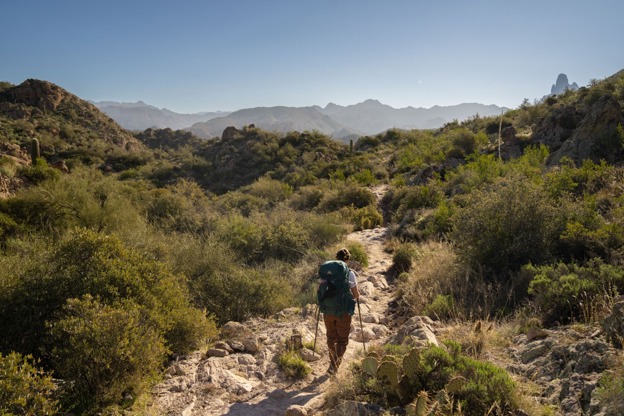
The park's 17 miles of trails range from short, easy loops to all-day treks, and many of the best routes link together, so you can build a hike to fit your time and energy. Grab a free hiking guide before you set out.
|
Trail |
Round-trip distance |
Difficulty |
Highlight |
|
Bonita Creek Trail |
0.2 miles |
Easy |
Accessible loop near the campground |
|
The Grottoes |
1 mile |
Easy |
Rock caverns and corridors carved by water |
|
Sugarloaf Mountain |
1.8 miles |
Moderate |
Summit fire lookout with panoramic views |
|
Echo Canyon Loop |
3.3 miles |
Moderate |
Towering spires, narrow passages, shaded canyon floor |
|
Heart of Rocks |
About 7.3 miles |
Strenuous |
Big Balanced Rock, Punch and Judy, and other famous formations |
|
Big Loop |
9.5 miles |
Strenuous |
A full-day route through nearly every major area of the park |
For a first visit, the Echo Canyon Loop is the best introduction to the park's rock formations. Plan on two to four hours.
Tip for Standard RV renters: You don't need to drive the scenic road to reach Heart of Rocks. The route can start at the bottom of Rhyolite Canyon near the campground, though it gains about 1,600 feet from there.
Hiking tips:
-
Start early, especially in summer, and pack more water than you think you'll need.
-
Watch for afternoon thunderstorms, and avoid exposed overlooks and the Sugarloaf summit when lightning is possible.
-
The elevation is higher than at most desert trailheads, so pace yourself.
Experienced hikers can combine segments like Ed Riggs, Mushroom Rock, and Sarah Deming to customize a longer loop.
Things to Do Beyond the Trails
Tour Faraway Ranch
About a mile past the entrance, Faraway Ranch preserves the homestead of Swedish immigrants Neil and Emma Erickson, who settled here soon after marrying in 1887. Their daughter, Lillian Erickson Riggs, and her husband, Ed, later ran it as a guest ranch and championed protecting the surrounding rock formations, which helped lead to the 1924 monument designation. You can walk the grounds year-round, and ranger-led tours of the ranch house are offered during parts of the spring and summer. Nearby, the 1880 Stafford Cabin is one of the oldest in the state.
Dig into the Park's Cultural History
The Chiricahua Apache have called this region home since the early 1400s. After the Civil War, Buffalo Soldiers were stationed here during the U.S. Army's campaigns against Apache leaders Geronimo and Cochise, and some of their stone inscriptions survive in the ranch house fireplace. Civilian Conservation Corps crews followed in the 1930s, building the original campground.
Stargaze Under Some of the Darkest Skies in the Southwest
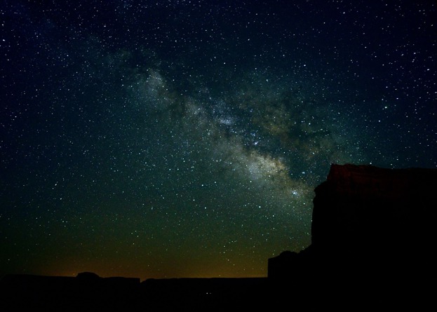
In 2021, Chiricahua became the 104th certified International Dark Sky Park in the world. The Faraway Ranch and Echo Canyon parking lots are two of the best spots for viewing the Milky Way on a clear, moonless night.
Where to Camp With an RV
Bonita Canyon Campground
Bonita Canyon Campground is the only campground inside the park, and camping here is by reservation only. Shaded by oak and pine, it has 25 individual sites plus one group site that holds up to 24 people. The bed of Bonita Creek winds through the grounds; it stays dry most of the year and runs only during the summer monsoon or after winter snows.
Size is the deciding factor. Vehicles must be under 29 feet, bumper to hitch, and your total length has to fit the campsite's driveway length, which is listed on the campground map. Many sites are short or uneven, which makes them better suited to tent campers, vans, and smaller RVs. Check the details for each site on the campground's Recreation.gov page before you book.
|
Available |
Not available |
|
Flush toilets and running water |
Hookups of any kind |
|
Picnic table and stand-up grill at each site |
Showers |
|
Food lockers |
Dump station |
|
Gray water disposal for dishwater |
Filling RV water tanks |
Campground rules to know:
-
Quiet hours run from 8 p.m. to 8 a.m. Generators allowed only 8 to 10 a.m. and 4 to 6 p.m.
-
Food storage: Keep all food, coolers, cookware, and garbage in the food lockers or a closed vehicle. Food items left unattended for more than an hour may be discarded.
-
Wildlife: Feeding wildlife, including with bird feeders, is prohibited and can lead to a fine.
-
Fire: No ground fires are permitted. Cook on your grill using common fuels like charcoal or pest-free firewood. Rules added in 2025 ban hazardous materials, so starting a fire with flammable liquids, garbage, plastics, or other synthetic materials is strictly prohibited. Expect extra fire restrictions from April through June.
Reservations, Late Arrivals, and No-Shows
All sites are booked through the Recreation.gov reservation system. Reserving ahead is essential for a large vehicle, on holidays, and during spring break in March and April. The campground and road stay open all night, so late arrivals can still check in after dark; just keep the noise down.
Claim your site within 24 hours of check-in: you need to arrive by noon on day two or update your booking, or it may be canceled. Park staff can't hold reservations for you. If you won't use a reserved night, make a reservation modification on the app or website to protect the rest of your stay and possibly get a partial refund. If you experience technical issues, call Recreation.gov at 877-444-6777.
Full-Hookup RV Parks Nearby
For hookups, showers, a dump station, or room for a Large RV, base yourself outside the park:
-
Goldminers RV Park (Pearce): All pull-through sites fitting rigs up to 72 feet, 30- and 50-amp service, a bathhouse, laundry, Wi-Fi, and a dog park
-
Willcox Wine Country KOA Holiday (Willcox): Full hookups with up to 50-amp service, big-rig pull-throughs, and easy I-10 access near the local wineries
Best Time to Visit
The park is open year-round, and each season changes the experience:
|
Season |
What to expect |
Tips |
|
Spring (March to May) |
Pleasant hiking weather and the biggest crowds; March is the busiest month |
Reserve campsites early, and check fire restrictions, which are common from April through June |
|
Summer (June to September) |
Warm days, with afternoon thunderstorms during the summer monsoon |
Hike early, and get off exposed ridges before storms roll in |
|
Fall (October and November) |
Mild temperatures, clear skies, and fewer visitors |
A favorite window for both hiking and stargazing |
|
Winter (December to February) |
Cool, quiet days; snow and freezing nights are possible at higher elevations |
Pack warm layers, and watch for icy patches on shaded trails |
For the best balance of weather and solitude, aim for fall. In winter, add a stop at nearby Willcox Playa, where tens of thousands of sandhill cranes spend the season.
Build a Southeast Arizona RV Road Trip
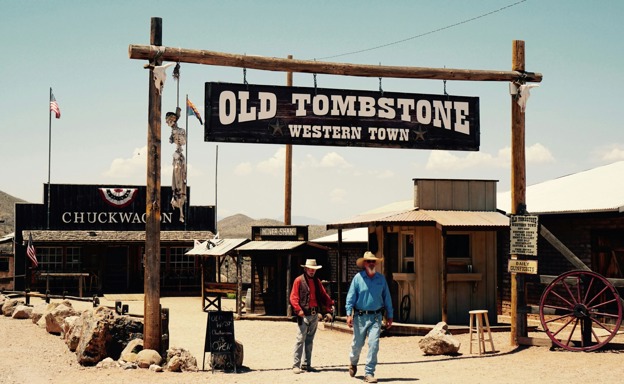
The park pairs well with a loop through the region's frontier towns, caves, and wine country. Here's a suggested five-stop trip from Tucson:
-
Kartchner Caverns State Park (Benson): Tour a living limestone cave about 35 minutes west of Willcox.
-
Willcox wineries: Sample local wines along the Willcox Bench, a short drive from town.
-
Fort Bowie National Historic Site: About 20 miles from the park, a 1.5-mile trail leads to the ruins of an 1860s Army fort at the center of the Apache Wars.
-
Bisbee: Explore a colorful former copper-mining town about 80 miles southwest of the park.
-
Tombstone: Finish in the famous Old West town about 65 miles from the park before heading back to Tucson.
Cochise Stronghold, the rugged canyon hideout of the Apache leader Cochise, makes an easy detour for hikers between Willcox and Tombstone.
Plan Your Chiricahua RV Trip With Cruise America
America's newest park rewards travelers who plan around its narrow roads and small campground, and the right RV makes all the difference. Pick up a Compact or Ultra Compact RV from Cruise America's Tucson or Phoenix location, and you'll fit everywhere the park allows: the campground, the scenic drive, and every trailhead lot. Skip the hotel bookings, set your own pace, and use our online trip-planning tools to map out your southeast loop. Book your RV now!